Lead faster. Lead smarter. Lead with AI
Category
Product
Client
Better Cotton Intitative, Geneva

Completed and submitted all project deliverables
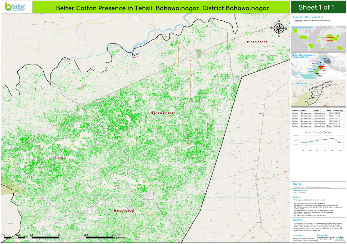
Project scope: 21 districts (10 in Punjab and 10 in Sindh), using open-source data
Georeferencing: Survey of Pakistan and Election Commission maps for data collection
District Boundaries: 21, plus 3 pilot project districts
Tehsil Boundaries: 94 digitized
Union Council Boundaries: 1,319
Mouza/Village Boundaries: 9,190
Ginners and Spinners: 701 geocoded, with 1,649 across Pakistan
Health Facilities: 1,674
Landmarks: 6,873
Farmers (Learning Groups & Medium Scale): 18,353 geocoded and ground-verified
Settlements Data: 21,539 developed
Conducted field surveys to verify developed data·
Raster Analysis on Cotton Crops: Cotton crop mask for areas cultivated with cotton in at least three of the last five seasons
Complete repair of old records according to client requirements
Digitized 2500 maps, scanned at 600 DPI for high-resolution quality
various categories and sizes of digitized maps of Pakistan Railways
Software and dashboards developed for easy retrieval and management of maps
Data Analysis:
Assessed PU boundary alignment with administrative units
Analyzed LG distribution relative to cotton-cultivated areas
Identified overlapping PU areas and areas suitable for future interventions
Performed analysis on LG clustering, dispersion, and saturation for expansion or consolidation
Evaluated PU formation based on dispersion, crop mask overlap, and boundary alignment
Technology Integration:
Integrated with Google Earth Engine for data handling
Developedse Power BI dashboards for insights
Created WebGIS and interactive maps
Established a Management Information System (MIS) for effective management and internal u